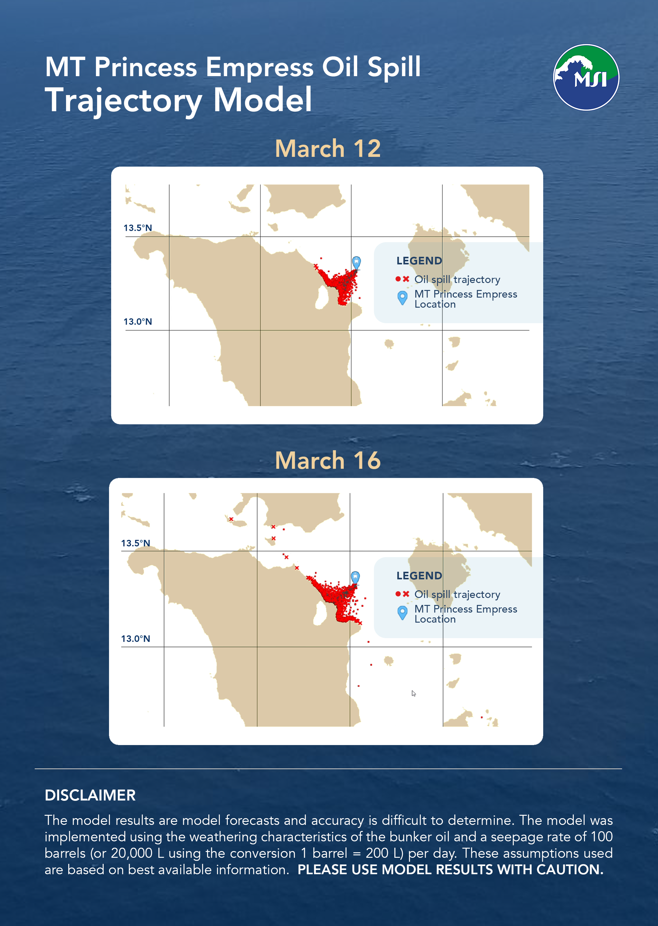
Bulletin 07: Oil spill trajectory model forecasts that spill will reach other areas of the Verde Island Passage due to weakening Amihan
Featured image: Bulletin 07: Oil spill trajectory model forecasts that spill will reach other areas of the Verde Island Passage due to weakening Amihan
The recent simulation focusing on the area of the tanker’s location for March 10 to 16 shows that with continuous seepage of oil, most of the oil will end up along Naujan coast and Pola Bay. However, due to the weakening Amihan, some of the oil may flow northwards towards other areas of the Verde Island Passage by March 16, affecting coastal areas of Calapan, Verde Island, and some parts of Batangas. The oil spill threatens the global center of marine biodiversity located in the Verde Island Passage (VIP).
The VIP is the body of water between Batangas and Mindoro and it has the highest concentration of coastal fishes, corals, crustaceans, molluscs, seagrasses, and mangroves. The VIP is also home to endangered and threatened species including the critically endangered hawksbill turtle, whale sharks, manta rays, dugongs, humphead wrasses, giant groupers, and giant clams.
Damage from the oil spill may affect biodiversity (including endemic species only found in the Philippines as well as species yet to be discovered), tourism revenues, and food security in the area.
Disclaimer: The model results are model forecasts and accuracy is difficult to determine. The model was implemented using the weathering characteristics of the bunker oil and a seepage rate of 100 barrels (or 20,000 L using the conversion 1 barrel = 200 L) per day. These assumptions used are based on best available information. PLEASE USE MODEL RESULTS WITH CAUTION.
*Updated on March 13, 2023: There was a typographical error in the model description which originally stated a seepage rate of 1,000 barrels per day. The model in actuality used a seepage rate of 100 barrels per day. The model description has since been updated and corrected.

