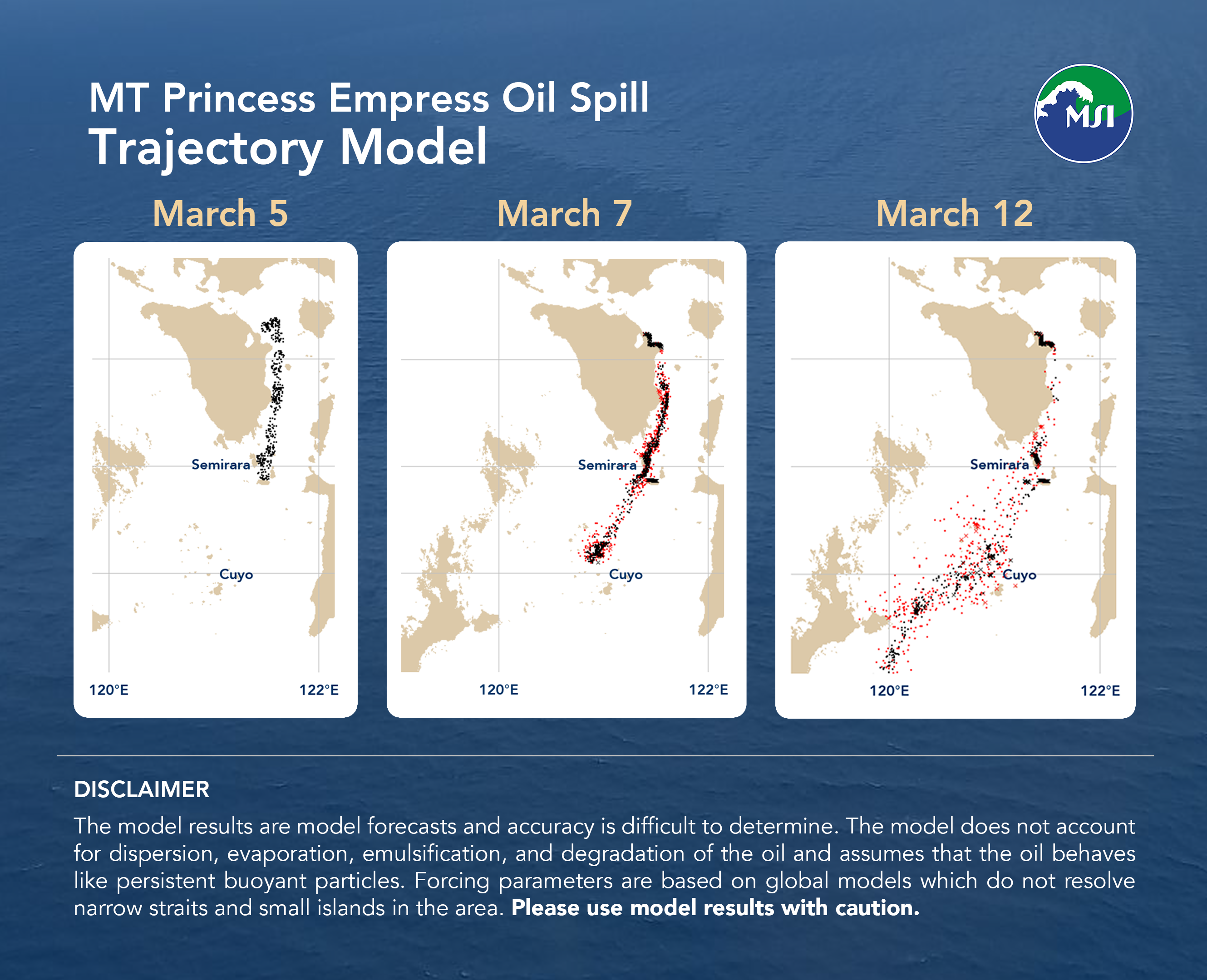
Bulletin 04: Model forecasts that spill will reach Cuyo Islands and get closer to northern Palawan in about a weeks time
Featured image: Bulletin 04: Model forecasts that spill will reach Cuyo Islands and get closer to northern Palawan in about a weeks time
The projected trajectory of the oil slick is shown in the images for March 7 and March 12, and initialized with spill locations in the image for March 5.
The projected spill will continue due southwest to Cuyo group of islands (as seen in the image for March 7) and will get closer to northern Palawan mainland in about a week’s time (as seen in the image for March 12).
Disclaimer: The model results are model forecasts and accuracy is difficult to determine. The model does not account for dispersion, evaporation, emulsification, and degradation of the oil and assumes that the oil behaves like persistent buoyant particles. Forcing parameters are based on global models which do not resolve narrow straits and small islands in the area. Please use model results with caution.

