
Submarine volcanoes, faults, internal wave generation zones, and a region for potential renewable energy surveyed in Sulu Sea, Celebes Sea, and southern Philippine Sea
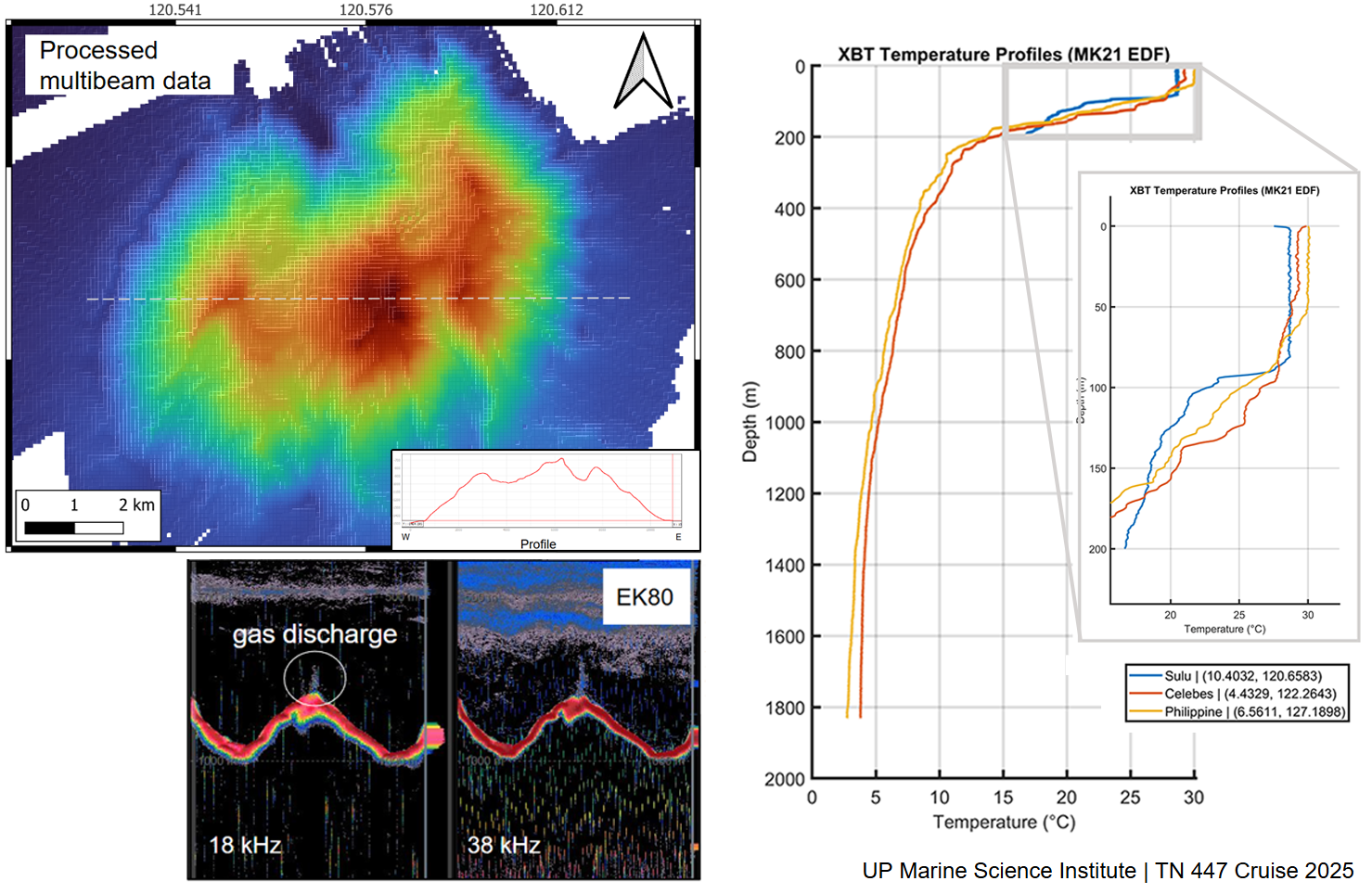
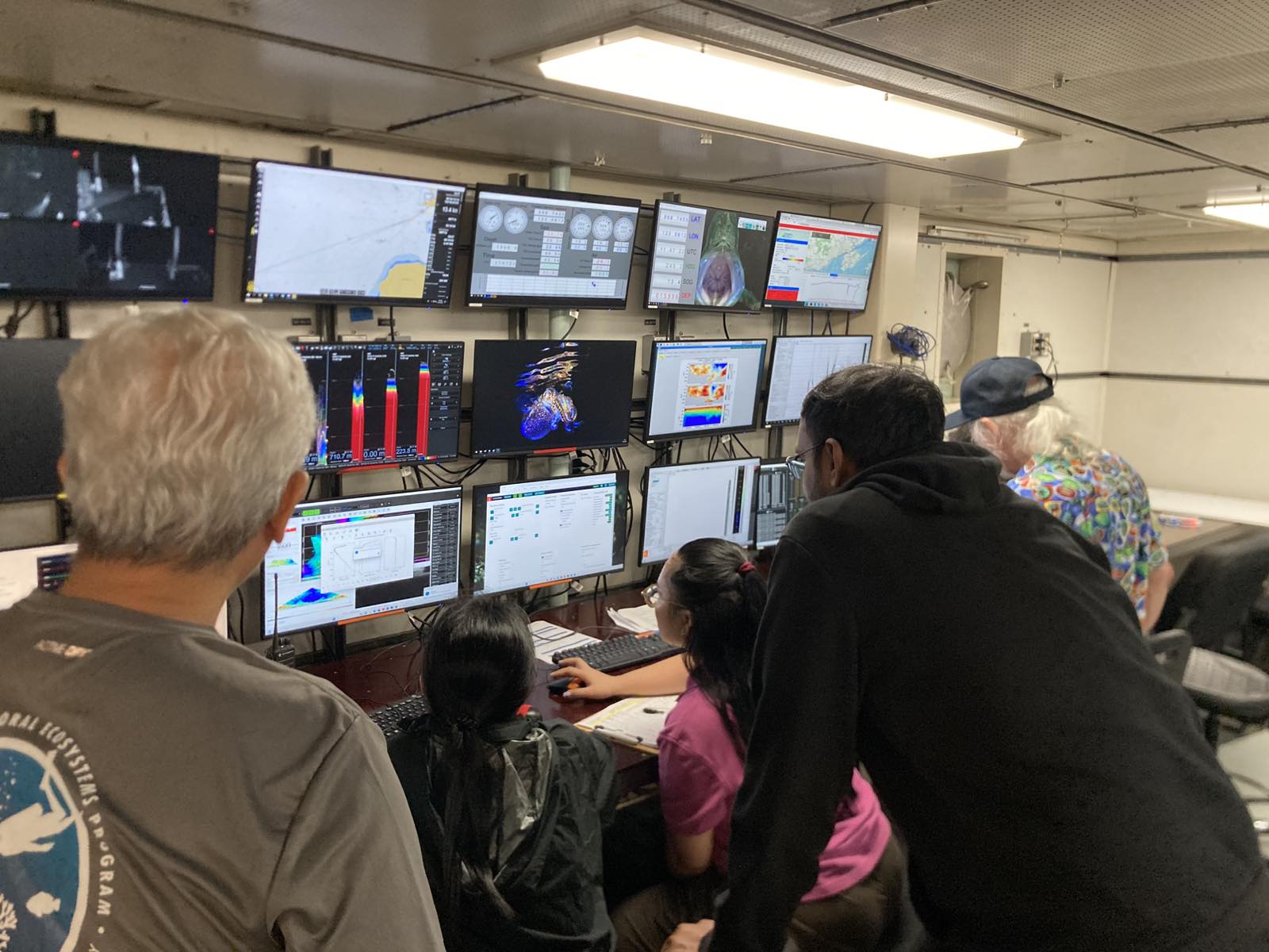
FEATURED PHOTO: The height and shape of a submarine volcano spotted in the Sulu Sea (top left). Echosounder data (bottom left) shows gas discharge likely emanating from the volcano. On the right, temperature profiles of the Sulu Sea, Celebes Sea, and Philippine Sea show their potential for renewable ocean energy.
QUEZON CITY, PHILIPPINES — Submarine volcanoes, active faults, internal waves, and a region with potential for renewable energy were surveyed in the Sulu Sea, Celebes Sea, and southern Philippine Sea, reported by scientists from the UP Marine Science Institute.
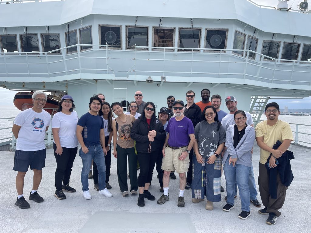
Dr. Fernando Siringan and Dr. Charina Lyn Amedo-Repollo shared these results from a recent expedition to Sulu Sea, Celebes Sea, and the southern Philippine Sea in their talk “Mapping the ocean environment through acoustics: Field data of the RV Thompson TN 447 Cruise,” held at the Edgardo D. Gomez Hall on February 3, 2026.
The expedition was conducted by the UP Marine Science Institute jointly with scientists from the University of California – Santa Cruz and Mindanao State University – Naawan in December 2025. The Philippine team included geological oceanographers, physical oceanographers, and chemical oceanographers.
Dr. Fernando Siringan led the Philippine team, while Dr. Daniel Orange led the whole expedition as the principal investigator.
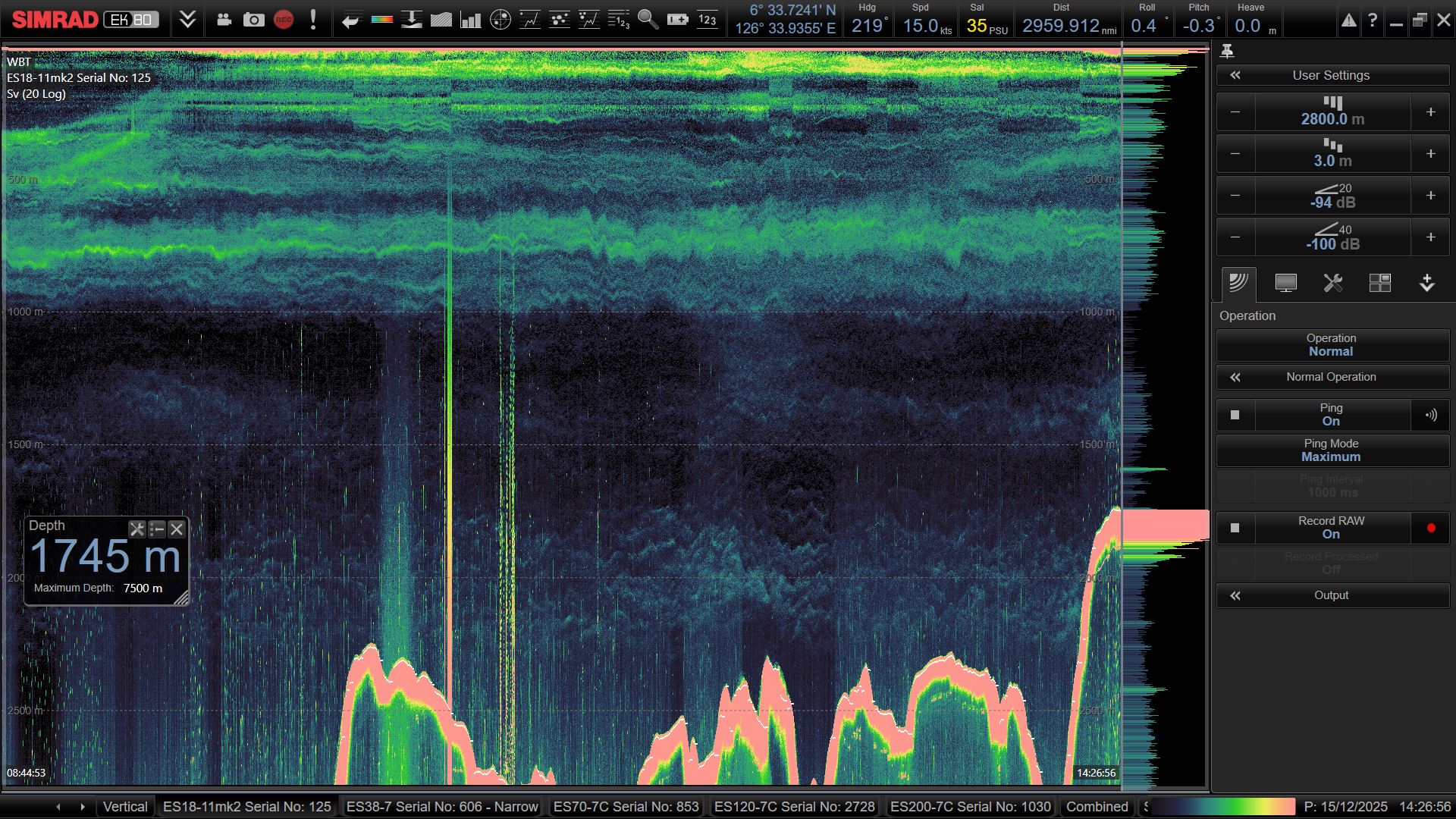
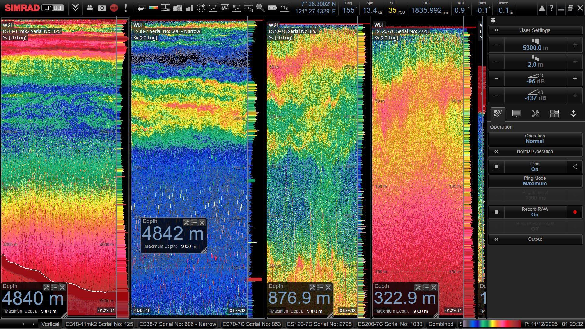
The hull-mounted multibeam of R/V Thomas G. Thompson provided detailed bathymetry and seafloor roughness of suspected submarine volcanoes based on NAMRIA and GEBCO maps. In one of these targeted volcanic features in the Sulu Sea, the EK80—a sonar device which scans the water column—imaged a vertically-oriented anomaly extending by about 30 meters from the top of the volcanic feature into the water column. This anomaly is likely caused by hydrothermal gases discharged by the volcano, said Dr. Siringan, who leads the Geological Oceanography Laboratory.
This anomaly is likely caused by hydrothermal gases discharged by the volcano, said Dr. Siringan, who leads the Geological Oceanography Laboratory.
In the Celebes Sea, a volcanic feature just south of Balut Island was found to have a morphology indicative of a caldera. Dr. Siringan said that volcanic edifices are conducive to unique marine life, which may yield unique bio-compounds with potential for industrial and pharmaceutical products.
He shared his previous experience at the Philippine Rise, where his team found sea stars, sea lilies, and Iridogorgia corals at depths of 1300 meters.
“Anywhere you have gas seeps and hydrocarbon seeps, the biodiversity is relatively unique compared to surrounding areas. That’s why it’s an area of interest for both geologists and biologists,” Dr. Siringan explained.
The UP Marine Science Institute has several studies on the potential of Philippine marine biodiversity for drug development. Though no compounds have been sourced from the deep sea yet, research on shallow water cone snails has led to the development of the analgesic ziconotide. More recently, significant progress has been made on using compounds from the Philippine blue sponge to assist in the treatment of breast cancer.
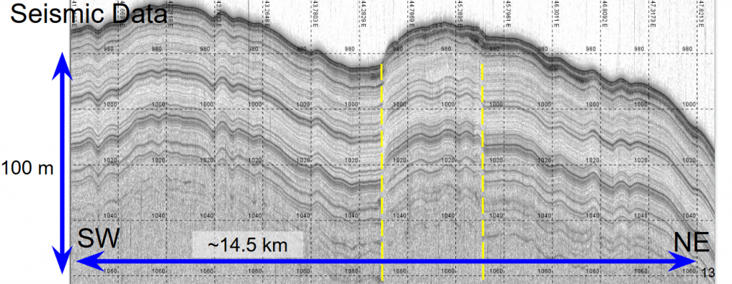
Palawan, often dubbed “the safest place in the Philippines” due to its lack of earthquakes, is commonly thought to have no active faults. However, on this voyage, researchers found previously unmapped faults off eastern Palawan.
One of these is along the continental slope. The fault, which cuts through the surface, shows a displacement of about 10 meters. Along the projected extension of the Ulugan Bay Fault, a series of faults cut through the sediment packages over a span of about 20 kilometers.
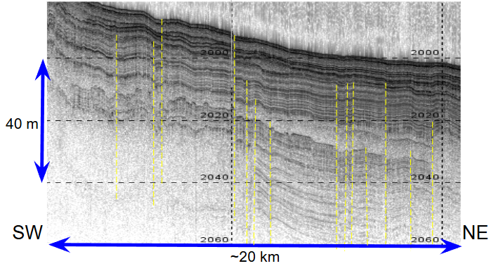
Dr. Siringan explained that the findings are consistent with the findings of French and German scientists, who previously mapped several faults while doing hydrocarbon exploration-related research in the Sulu Sea.
Researchers of the Philippine Institute of Volcanology and Seismology (PHIVOLCS) attributed the 5.1 magnitude earthquake that hit Palawan on June 11, 2024 to one of the previously mapped faults in the area. Dr. Siringan hypothesized that the alignment of volcanic features on the west side of Sulu Sea with the Manguao Volcano in Taytay, Palawan may also be related to one of these faults.
He advocated for a reassessment of the geology of Palawan, especially because of the identification of Palawan as a possible site for a nuclear power plant.
In the southern Philippine Sea, physical oceanographers uncovered deep ocean processes that can support a productive fisheries industry and new ventures into renewable energy.
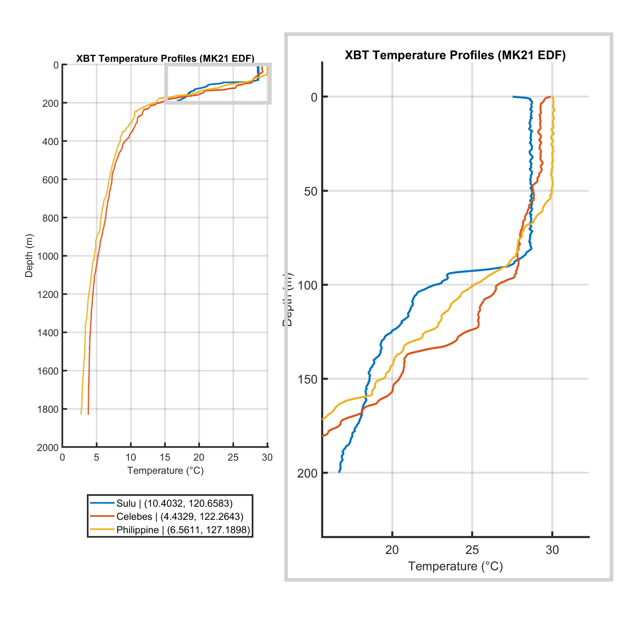
Recent oceanographic observations reveal that the southern Philippine Sea could be a prime location for ocean energy operations. Ocean Thermal Energy Conversion (OTEC) is technology that harnesses this temperature difference between warm surface waters and colder waters at depth. To operate efficiently, OTEC systems typically require a temperature contrast of at least 20°C, which in many parts of the world means drawing cold water from depths of 800 to 1,000 meters or deeper.
According to Dr. Charina Lyn Amedo-Repollo, who leads the Physical Oceanography and Observation Laboratory, this critical 20°C temperature difference between the surface and the depths is already observed at approximately 200 meters.
The sharp contrast in temperature, as measured with the expendable bathythermograph (XBT), is considerably shallower than what is observed in many other tropical regions.
This is explained by the unique characteristics of the southern Philippine Sea. It is an open-ocean environment exposed to strong solar heating and shaped by large-scale ocean circulation. These conditions create the warmest and most consistent upper-ocean temperatures among the surveyed seas, and its water temperatures drop rapidly with depth.
“The strong surface-to-deep temperature contrast observed in the southern Philippine Sea meets the thermal requirements for OTEC, indicating high potential for continuous baseload renewable energy, with additional applications for desalination, and seawater cooling,” said Dr. Amedo-Repollo.
Dr. Amedo-Repollo further explained that this pronounced thermal structure is influenced by the major currents along the eastern coast of Mindanao.
Measurements collected during the R/V Thompson expedition reveal that the interaction between the southward-flowing Mindanao Current and the northward-flowing Mindanao Undercurrent produce a deep shear layer. This shear layer is observed approximately 600–700 meters deep, and is characterized by sharp velocity and density gradients that affect stratification in the water column.
Critically, this interaction between such strong currents also gives rise to internal waves and internal tides—large, slow-moving waves that travel beneath the ocean surface. When strong currents flow across rugged sea floors and through narrow passages, they generate powerful underwater waves that mix the ocean from below.
In places like the Basilan Strait and over the Sangihe Arc, the ocean floor is steep and highly complex. As a result, these areas become natural hotspots for internal waves, enhancing ocean mixing and supporting life beneath the surface.
This mixing plays a vital ecological role. As internal waves break and fade, they help carry nutrients from deeper waters toward the surface, fueling the growth of plankton—the foundation of marine food webs. Over time, this process helps explain why regions influenced by strong internal wave activity often coincide with productive fishing grounds, linking ocean physics directly to food security and fisheries sustainability.
Dr. Amedo-Repollo explained that these findings show how understanding the ocean’s layered structure—from surface currents to deep-water interactions—can guide decisions on renewable energy development, fisheries management, and the broader blue economy of the Philippines.
“We don’t only see water. We see opportunities for future work,” said Dr. Amedo-Repollo.
From clean, continuous energy to resilient fisheries, the southern Philippines highlights how processes beneath the waves can help shape sustainable solutions for communities above them.
Despite being bordered by the world’s deepest waters, the depths of the Philippines remain underexplored. Most marine research in the country focuses on shallow, coastal waters.
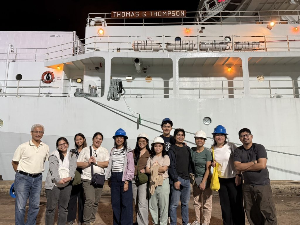
Venturing into the open ocean and going deeper often requires external support. The expedition to the Sulu Sea, Celebes Sea, and South Philippine Sea was conducted aboard the R/V Thomas G. Thompson, an American deep-sea research vessel, and was funded by the US Office of Naval Research.
Notably, this expedition marked the first time water samples were collected from a depth of 5200 meters in the Celebes Sea.
Former DENR Secretary Ma. Antonia Yulo-Loyzaga lauded the expedition, saying the research was “critical.” Captain Armil Angeles (Ret.) of the Presidential Office for Maritime Concerns expressed his support for more Philippine deep-sea studies.
“There’s a need for marine science research and to support marine science research. On our part as policymakers, we will do our part to support it,” he said.
The UP Marine Science Institute remains committed to serving national interests through marine science research.
“There’s a lot of attention on us because of the Coral Triangle, but I bet our deep sea is just as interesting,” said Director Dr. Laura David.