
Bulletin #01: Oil spill trajectory model forecasts that spill will reach Bulacan and Cavite
Featured image: Bulletin #01: Oil spill trajectory model forecasts that spill will reach Bulacan and Cavite
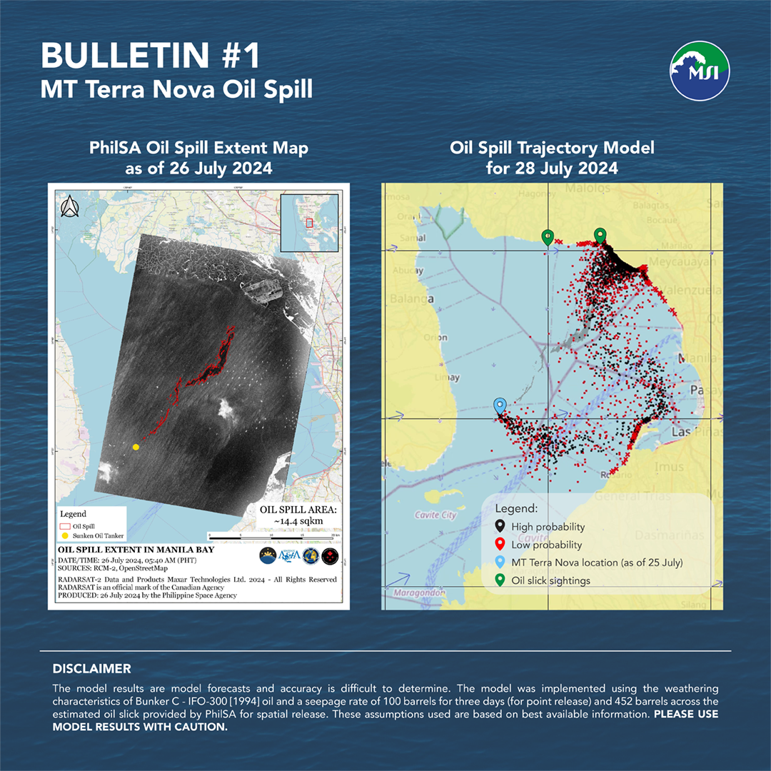
Through the collaborative efforts of the Department of Environment and Natural Resources, the Philippine Space Agency, UP MSI, and other national agencies, an oil spill trajectory model was run to forecast the transport of the slick based on prevailing weather patterns and conditions, and on recent information on the location of the slicks.
The model shows possible transport northwards to Bulacan confirmed by oil slick sightings, from the slick observed on July 26, 2024 5:40AM by PhilSA. Considering the continuous release of oil from the tanker, coastal areas of Cavite City may also be affected with the eastward change of forecasted winds today, July 28, 2024.
Models are generated to inform the public on the potential direction of transport of the oil spill and help direct response efforts on the ground. However, models have some levels of uncertainty due to assumptions and limitations, and thus, should be used with caution.
*Description of the Oil Spill Trajectory Model: The model used is the General NOAA Operational Modeling Environment (GNOME) for predicting the fate and transport of pollutants, such as oil, spilled into the ocean. The model for the MT Terra Nova spill uses surface velocity fields from Global Ocean Physics Analysis and Forecast and surface winds from the National Center for Environmental Prediction Global Forecast System. Spill location was specified based on the location of the sunken MT Terra Nova on July 25, 2024 provided by PCG and oil spill extent map provided by PhilSA dated July 26, 2024. Information about the model is available at https://response.restoration.noaa.gov/gnomesuite.