
Bulletin #02: Oil spill trajectory model forecasts that spill will reach Metro Manila by July 30
Featured image: Bulletin #02: Oil spill trajectory model forecasts that spill will reach Metro Manila by July 30
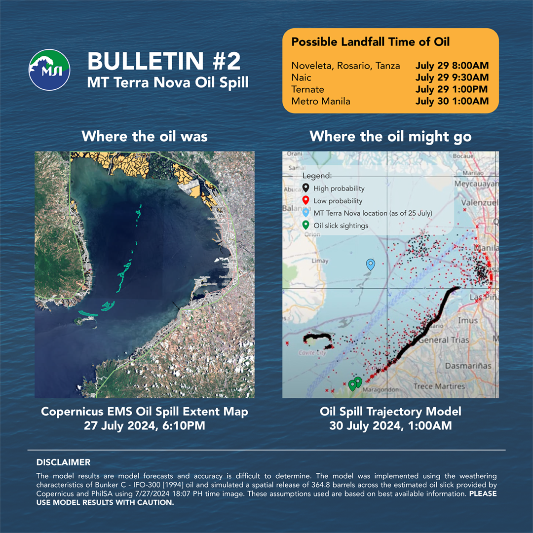
An oil spill trajectory model was run to forecast the transport of the slick based on prevailing ocean currents and weather patterns. From the location of the oil slick based on the satellite image dated July 27, 6:07PM, oil may be transported to the following coastal areas and are projected to landfall at these times:
Models are generated to inform the public on the potential direction of transport of the oil spill and help direct response efforts on the ground. However, models have some levels of uncertainty due to assumptions and limitations, and thus, should be used with caution.
*Description of the Oil Spill Trajectory Model: The model used is the General NOAA Operational Modeling Environment (GNOME) for predicting the fate and transport of pollutants, such as oil, spilled into the ocean. The model for the MT Terra Nova spill uses surface velocity fields from Global Ocean Physics Analysis and Forecast and surface winds from the National Center for Environmental Prediction Global Forecast System. Spill location was specified based on the oil spill extent map provided by Copernicus and PhilSA dated 7/27/2024 18:07 PHT. Information about the model is available at https://response.restoration.noaa.gov/gnomesuite.