
Bulletin #04: PhilSA oil spill extent maps show smaller oil spill area on July 30 compared to July 28
Featured image: Bulletin #04: PhilSA oil spill extent maps show smaller oil spill area on July 30 compared to July 28
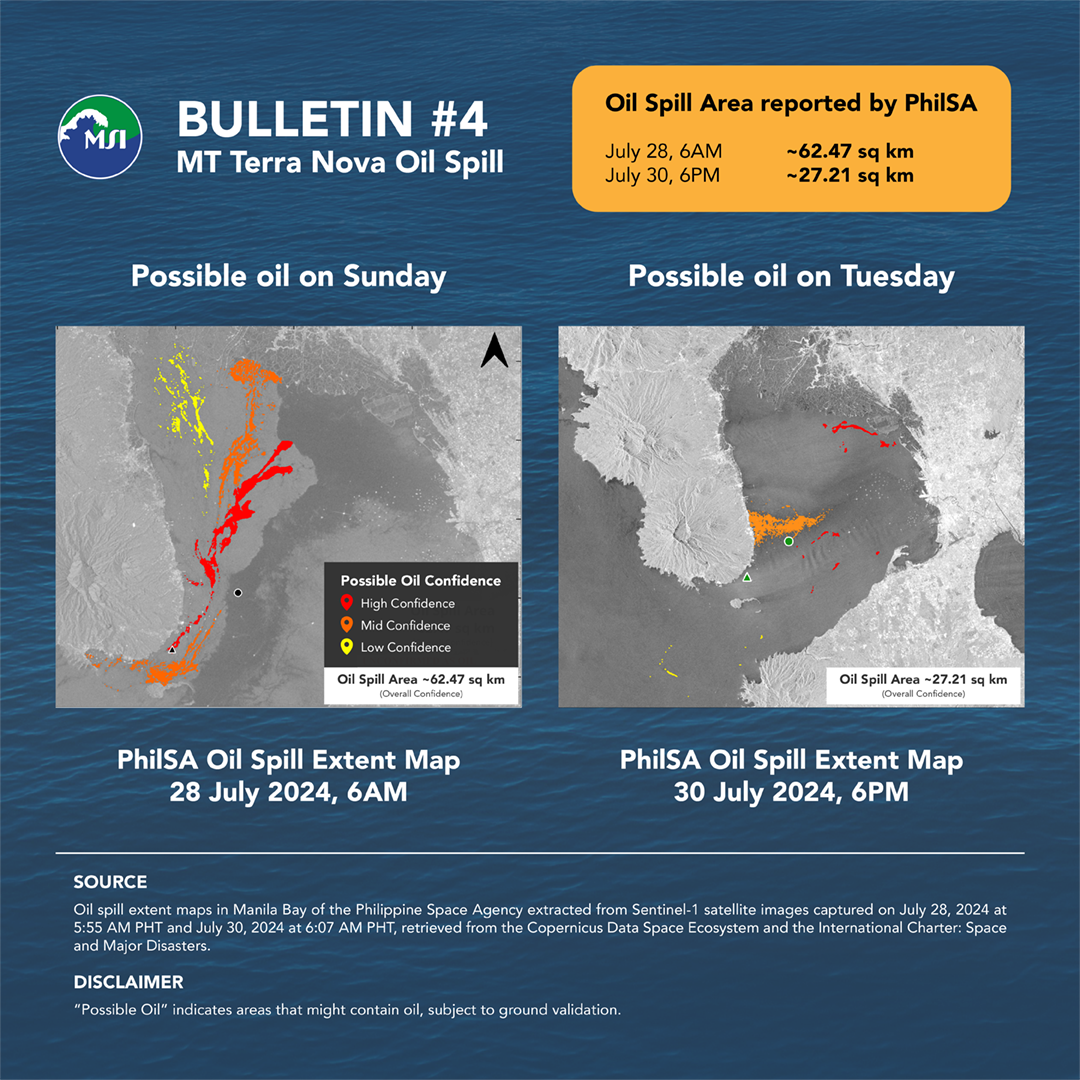
The Philippine Space Agency (PhilSA) uses satellite images to map the oil spill extent in Manila Bay. From the Sunday (June 28 6AM) satellite image, they mapped approximately 62 sq km oil spill area. The mapped oil spill area from the Tuesday (July 30 6PM) image is smaller at approximately 27 sq km, based on overall confidence.
Please be advised that the maps provided by PhilSA are subject to field validation.
PhilSA extracted oil spill extents from the Sentinel-1 satellite images captured on July 28, 2024 at 5:55 AM PHT and July 30, 2024 at 6:07 AM PHT, retrieved from the Copernicus Data Space Ecosystem and the International Charter Space and Major Disasters.
The maps may be downloaded from PhilSA’s post here.