
Bulletin 09: Oil spill trajectories show northward shift with Calapan possibly receiving most of the oil from March 20-22
Featured image: Bulletin 09: Oil spill trajectories show northward shift with Calapan possibly receiving most of the oil from March 20-22
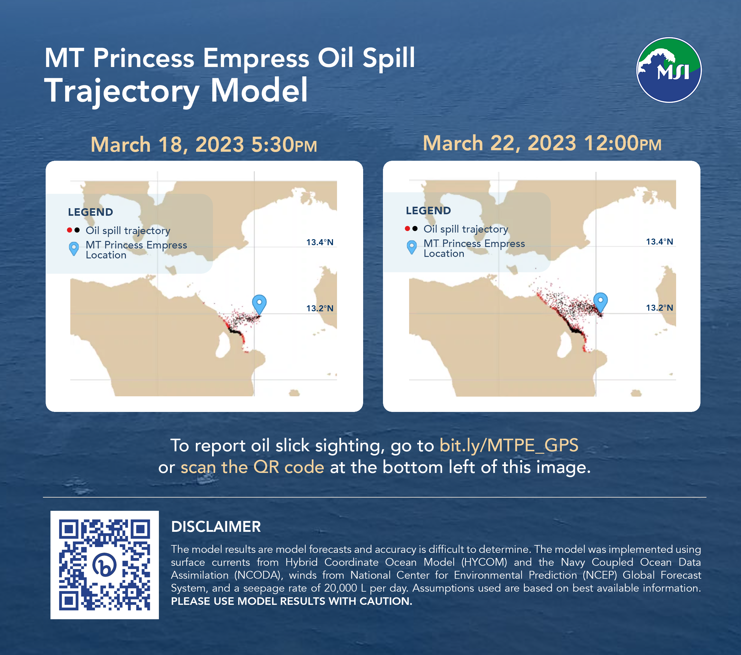
The latest satellite image on March 15 shows that the oil is still leaking out of the sunken vessel. Oil spill trajectories for March 16-22 show a northward shift with Calapan possibly receiving most of the oil from March 20-22. Westward currents along the coast of northern Mindoro towards the Verde Island Passage are forecasted to be more pronounced for this period. The Amihan winds, which contained most of the oil to the coasts of Nauhan and Pola in the previous weeks, are now more variable, allowing the oil to spread northwards. It is critical to stop the seepage before the end of the Amihan season, otherwise more critical biodiversity areas along the Verde Island Passage may be affected.
We need continuous monitoring along the coasts for the presence of oil to inform the models. The public is encouraged to contribute geotagged images using a GPS camera app (such as https://bit.ly/3ZVRg0y) so that coordinates can be used as starting locations for the oil in new model forecasts. Please submit these geotagged images through this form.
Disclaimer: The model results are model forecasts and accuracy is difficult to determine. The model was implemented using surface currents from Hybrid Coordinate Ocean Model (HYCOM) and the Navy Coupled Ocean Data Assimilation (NCODA), winds from National Center for Environmental Prediction (NCEP) Global Forecast System, and a seepage rate of 20,000 L per day. Assumptions used are based on best available information. Please use model results with caution.