
Bulletin 12: Large slicks northwest and southeast of sunken tanker — window of opportunity for oil collection
Featured image: Bulletin 12: Large slicks northwest and southeast of sunken tanker — window of opportunity for oil collection
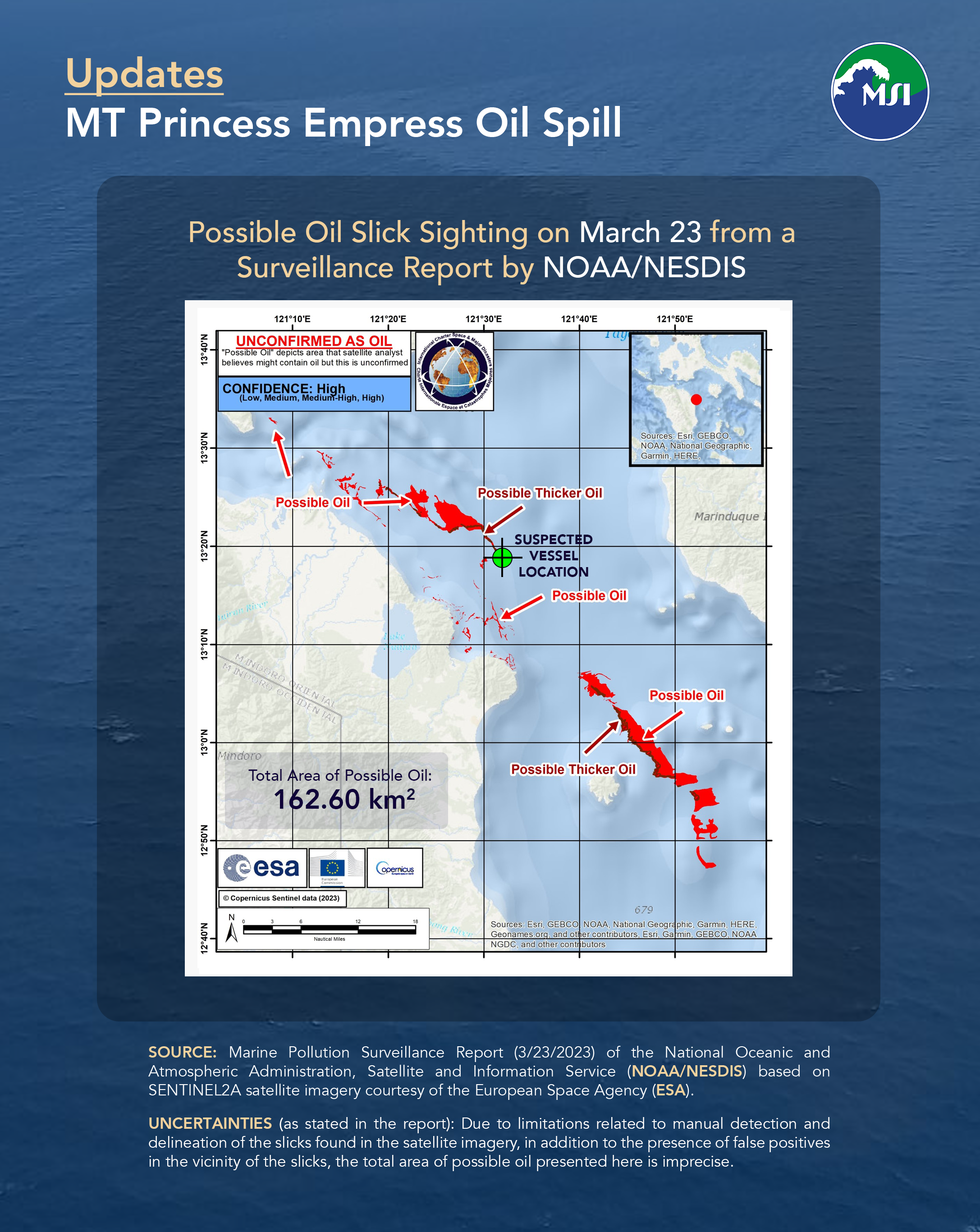
Weaker winds and calmer seas allow for larger oil slicks to form because of less disturbance from waves. Around 162.6 square kilometers of possible oil (same area as Quezon City) was observed as discrete oil slicks northwest and southeast of the sunken tanker, MT Princess Empress, in the latest US National Oceanic and Atmospheric Administration (NOAA) report based on a satellite image taken yesterday, March 23, at 10:15AM. The slicks floating in the area around the sunken tanker show that oil was still leaking out as of yesterday, March 23.
Calmer seas and larger slicks should be taken as an opportunity to collect the oil in slicks near the sunken tanker using booms and skimmers and ramp up cleanup efforts to prevent the oil from spreading further. The satellite pass included imagery stretching south of Mindoro, but no oil slicks were detected despite cloud-free skies.
Source: Marine Pollution Surveillance Report (3/23/2023) of the National Oceanic and Atmospheric Administration, Satellite and Information Service (NOAA/NESDIS) based on SENTINEL2A satellite imagery courtesy of the European Space Agency (ESA)
Uncertainties (as stated in the report): Due to limitations related to manual detection and delineation of the slicks found in the satellite imagery, in addition to the presence of false positives in the vicinity of the slicks, the total area of possible oil presented here is imprecise.