Bulletin 03: Over 36,000 ha of coral reefs, mangroves, and seagrass possibly affected by oil slick
Photo: Philippine Coast Guard

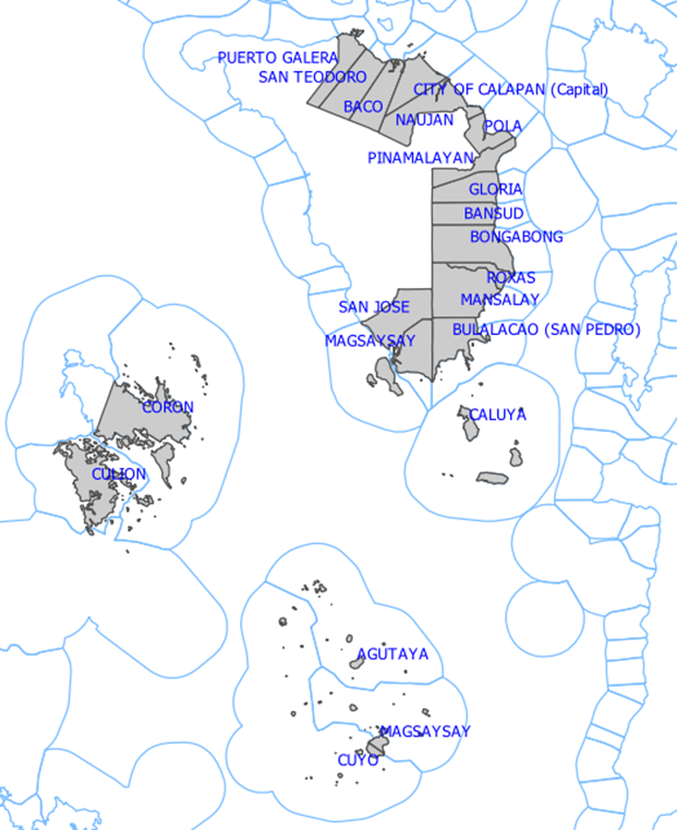
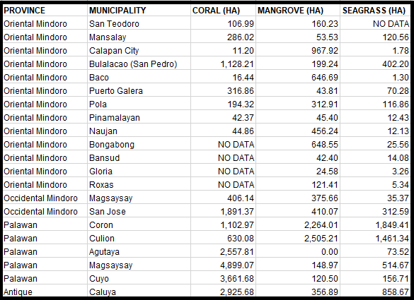
We would like to update and correct the area of affected coral reefs that we published in MSI Bulletin #01. Using the modeled oil spill trajectories (Bulletin #02), and looking at higher resolution data, we approximate that 20,000 ha of coral reef, 9,900 ha of mangroves and 6,000 ha of seagrass may be affected by the oil slick in the following municipalities (see table below). More than half of potentially affected reefs (11,000 ha) are found in the Cuyo group of islands.

The earlier estimate of 24,000 ha coral reef was arrived at using preliminary coarse resolution data, which resulted in an overestimation.
Among the coastal sites that may be at risk are several marine protected areas (MPAs) including but not limited to the reefs in Bulalacao, Oriental Mindoro, amounting to some 1,100 ha of coral reefs. Significant seagrass beds are present in several areas, including the coastal barangays of Pola, Mansalay, Bulalacao in Oriental Mindoro. Caluya Island in Northwestern Antique, which has a high possibility of being affected based on the oil spill trajectory model, also has significant areas of coral reefs (2,900 ha), mangroves (350 ha), and seagrass meadows (850 ha).
*Sources of habitat extents:
CORAL – PhilCoMaRS habitat data as of 2016-2017
MANGROVE – Based on the Mangrove Vegetation Index (Baloloy et al., 2020), mangrove extents in the Philippines were mapped using Sentinel-2 images.
Citation: Baloloy, A. B., Blanco, A. C., Ana, R. R. C. S., & Nadaoka, K. (2020). Development and application of a new mangrove vegetation index (MVI) for rapid and accurate mangrove mapping. ISPRS Journal of Photogrammetry and Remote Sensing, 166, 95-117. https://doi.org/10.1016/j.isprsjprs.2020.06.001
SEAGRASS – Allen Coral Atlas Benthic Map Citation: Allen Coral Atlas (2020). Imagery, maps and monitoring of the world’s tropical coral reefs. https://doi.org/10.5281/zenodo.3833242
*Updated on March 7, 2023: The table originally indicated 0 for the area of coral reefs in Bongabong, Bansud, Gloria, and Roxas, and 0 for the area of seagrass in San Teodoro. It has since been updated and corrected to NO DATA due to limitations of satellite data.

