
Fishing in a Vortex: How ocean currents affect biological productivity
By. Mia N. Judicpa & Gabrielle A. Abrahan
Around four months a year, we experience a respite from our tropical climate when the weather starts to chill. During Christmas, we wear thick clothes as winds from Siberia and China descend upon our mornings and bring with them good — and cold — tidings.
These winds prevail during the northeast monsoon season, which we know locally as Amihan. It is one of the two seasons our country experiences annually. They visit us from November to late March, and are followed by the winds that blow during the southeast monsoon season, called Habagat, after the transition months of April–May.
How do these winds interact with our waters and islands? What else do these winds bring?
Weather in the ocean
The winds interact with the ocean to generate currents that redistribute heat around the world, thereby regulating and stabilizing climate patterns. Ocean currents may also be driven by the earth’s rotation, the tides, and by differences in water density.
If you zoom out, you will see large circular ocean currents formed by global wind patterns and forces created by Earth’s rotation called gyres. Five major gyres occupy the earth’s oceans: the North and South Pacific Subtropical Gyres, the North and South Atlantic Subtropical Gyres, and the Indian Ocean Subtropical Gyre. Aside from the larger and more permanent gyres, there are many types of currents: eddies, whirlpools, deep ocean currents, and jet streams.1
Eddies at the back of an island form when stronger winds interact with the rugged terrain of the island or an oceanic flow passes the island. They are vortex-like phenomena that can last for months, and may be as small as a couple of centimeters or as large as hundreds of kilometers across. The swirling motion of eddies causes nutrients normally found in colder, deeper waters to rise to the surface. With enough light for photosynthesis to occur, this process influences the biological productivity of the area.2-5
Mesoscale (large-scale, less than 100 km) eddies are frequently observed in the seas around and within the Philippine archipelago. The multitude of embayments and isolated deep seas within a network of interconnecting straits, coupled with the complex bathymetry of the ocean floor and the rugged topography of the Philippines, all contribute to the formation of eddies.

Curiosities in Panay Strait
Dr. Charina Lyn Amedo-Repollo was born on Panay Island, the westernmost island in the Visayas. She tells us how her work in physical oceanography began right in her hometown:
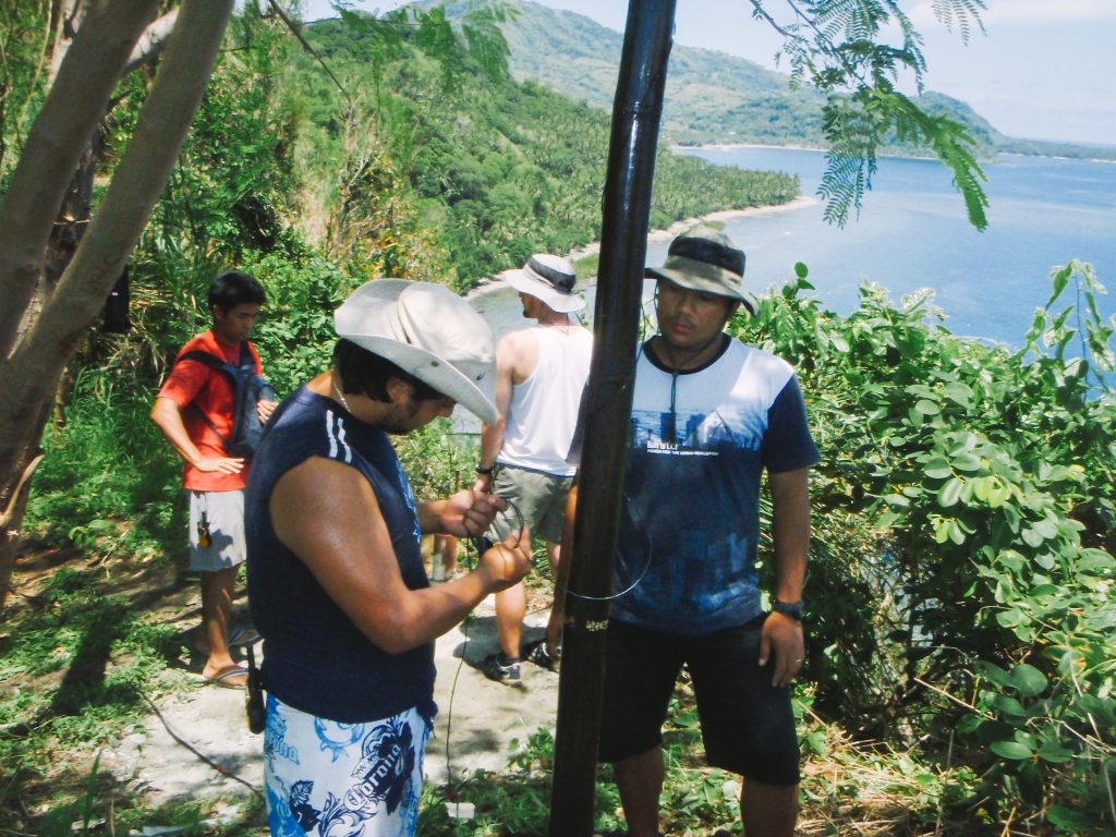
“When I [returned to research], a professor from the University of Hawai’i was looking for students to be trained in handling and operating the high-frequency (HF) radars. There was a big program in collaboration with UP MSI, the Philippine Strait Dynamics Experiment. Since he was looking for a student to train, I was recommended by Dr. [Cesar] Villanoy because he knows I was born and raised in Panay. This helped me a lot in selecting the sites, managing the logistics, installing, operating, and maintaining the HF radars.”
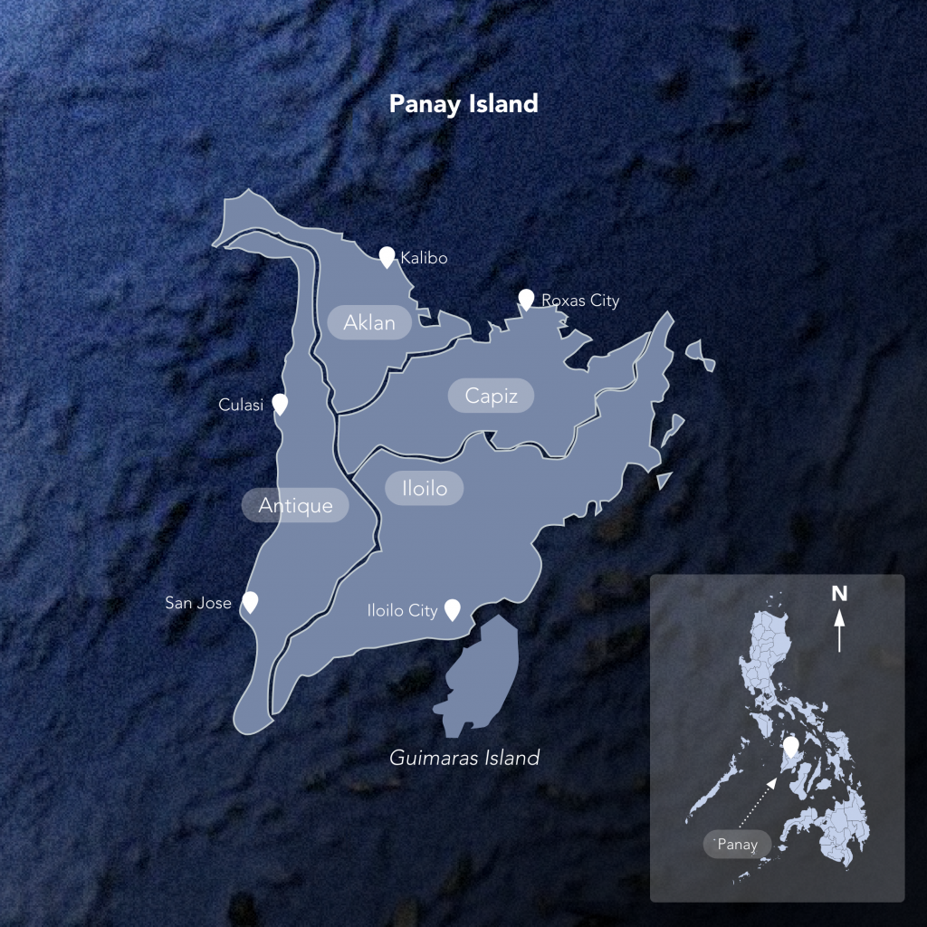
Boasting a productive maritime economy, Panay is bordered by the Iloilo and Guimaras Straits, Panay Gulf, and the Visayan, Sibuyan, and Sulu Seas.6 The topography of the island is dominated by mountain ranges and hilly areas on either side.
The Panay Strait is bounded by the coast of Panay Island on the east and the Palawan Island chain on the west. With the surrounding Semirara Sea, Panay shelf, Cuyo shelf, and Cuyo Group of Islands, the Panay Strait is a topographically intricate system consisting of shelves, small low-lying islands, seamounts, a deep basin, and sills forming the shallowest point within the strait.
Many oceanographic processes control the water flow here, including tides, sea level variations between the South China Sea and the Pacific Ocean, changing of the monsoon seasons, the El Niño–Southern Oscillation (ENSO), and the episodic occurrence of tropical cyclones.7-11
The many features within and surrounding Panay Strait make it an ideal location for eddies to form.
The publication,Low-frequency surface currents and generation of an island lee eddy in Panay Island, Philippines12, describes water flow and movement in Panay Strait, identifying prevalent eddies and jet flows. Intensive observations from the cruise and satellite images support the findings that there are regions in Panay Strait that are productive biological hubs.
Using remote sensing to map water movements
Dr. Repollo and her colleagues used a specialized shore-based remote sensing system with over-the-horizon (OTH) radar technology to monitor ocean surface currents. They were able to detect eddy formations that generate upwelling. Upwelling is an oceanographic process in which currents bring cooler, and usually nutrient-rich, deep water towards the ocean surface. These nutrients “fertilize” surface waters, thus often have high biological productivity and therefore, good fishing grounds.
With HF radars deployed in three points (Pandan, Laua-an and Tobias Fornier) along the coastline of Antique, they characterized the spatial and temporal variability of surface currents. They also used Acoustic Doppler Current Profiler (ADCP) data to describe the three-dimensional circulation in the area.
Phytoplankton blooms are indicators of marine ecosystem health. Correlating with the idea that eddy sites have high biological productivity, chlorophyll (a photosynthetic pigment present in all algal species) levels can be used as a proxy for phytoplankton biomass and indicate upwelling. Satellite ocean color technology is widely used to detect, map, and monitor chlorophyll. In the satellite images, the greener the color, the higher the chlorophyll concentration.
Local circulations
From the HF Radar data and chlorophyll-a level estimates, Dr. Repollo was able to identify two dominant phenomena in Panay Strait: the seasonal cyclonic Panay Eddy and its intensified eastern flow, the Panay Coastal Jet. She also described how monsoon patterns in the Philippines influence Panay Eddy formation.
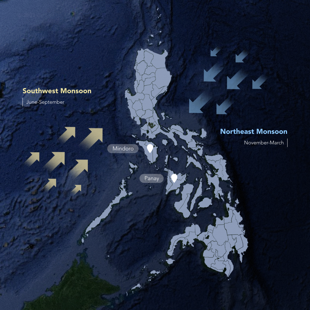
The Philippine archipelago contains many isolated circulations that are unique within the area. These local circulations are partly influenced by the seasonal reversal of the monsoon winds that the country experiences: the southwest monsoon from June to September and the northeast monsoon from November to March. The topographies of the ocean floor and of the surrounding land masses play a significant part as well.
The formation of Panay Eddy is due to the stronger and relatively stable northeast monsoon winds. As these winds blow across the mountainous islands of Mindoro and Panay, they intensify between islands and weaken at the lee or back of the island. This causes the winds to rotate counterclockwise (cyclonic) and generates upwelling.
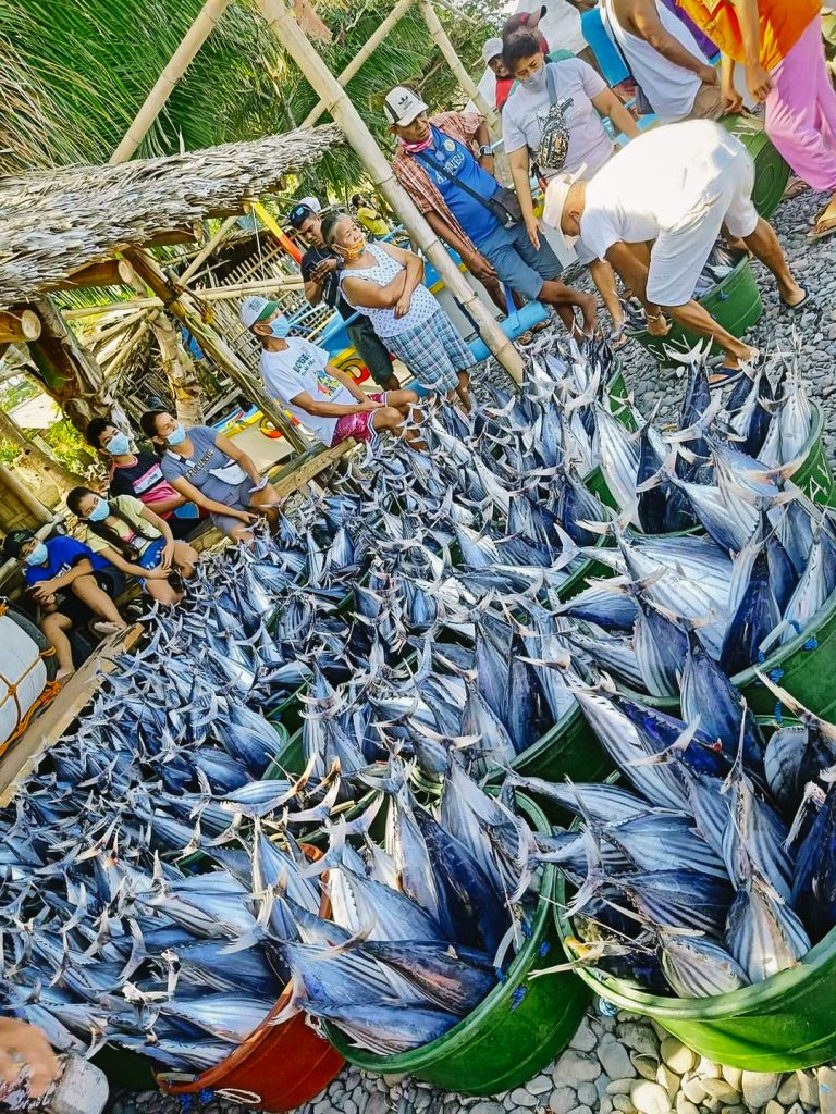
Upwelling brings cold, nutrient rich water from the depths of the ocean to the surface, which is important for primary productivity (algal growth). This, in turn, supports a richly productive marine ecosystem and is the reason for the abundant fisheries and sightings of large marine mammals in this region.
The Panay Eddy starts to form in November, peaks in February, and decays by late March. It is 100 km across in size, with an effective depth of about 130 m. Depending on the strength and direction of the prevailing Amihan, the center of the eddy may shift across the strait.
Linking physical oceanography and fisheries
If there is one huge difference between terrestrial and marine environments, it is that the latter constantly moves, impacting the supply of nutrients, sometimes enhancing the ocean’s productivity and, ultimately, the food web.
Dr. Repollo’s background in fisheries helped her establish the significant links between physical processes in the ocean and marine productivity.
“Actually, there are a lot of processes between that link. It takes time for you to be able to predict [implications of physical phenomena] into fisheries. But there are studies, including ours, that really link these processes [together]. When you observe a similar physical feature, usually, it is also high in biological production. Anywhere you go, upwelling areas will always be productive — they are known to be major fishing grounds.
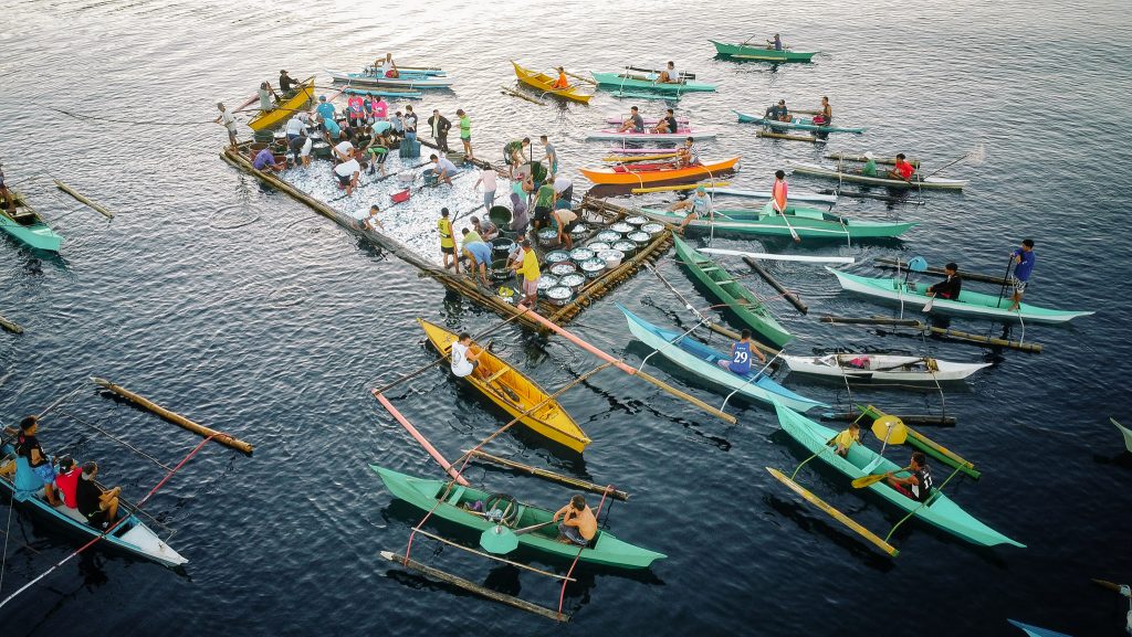
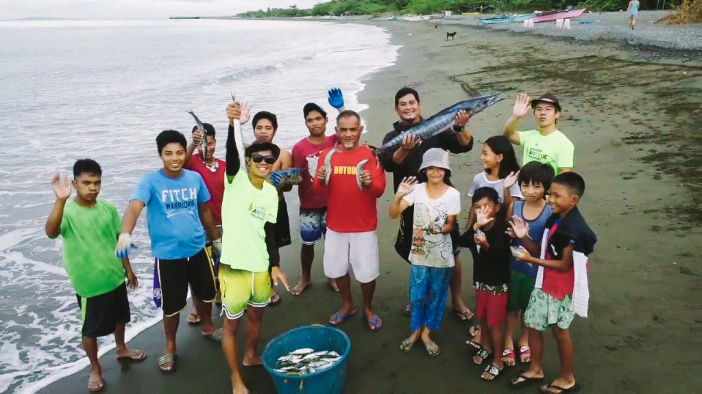
Fishmongers with buckets of skipjack tuna caught using kubkuban or ring nets in a fishing ground 21 kilometers away from the shore of Tibiao, Antique.
Photo: Discover Antique, Philippines Facebook Page
“This high productivity area is present not only in Panay but is prevalent in the west side of the country, particularly in the major islands of Luzon, Mindoro, Negros and Mindanao. How can we conserve and manage the resources that we have in that rich marine environment?
“The information we gathered and the results we published in peer-reviewed international journals need to be shared and conveyed at a level that the general audience, particularly the local government units and concerned agencies, can understand well for them to be able to create informed decisions on their management and conservation plans.”
Acknowledgments
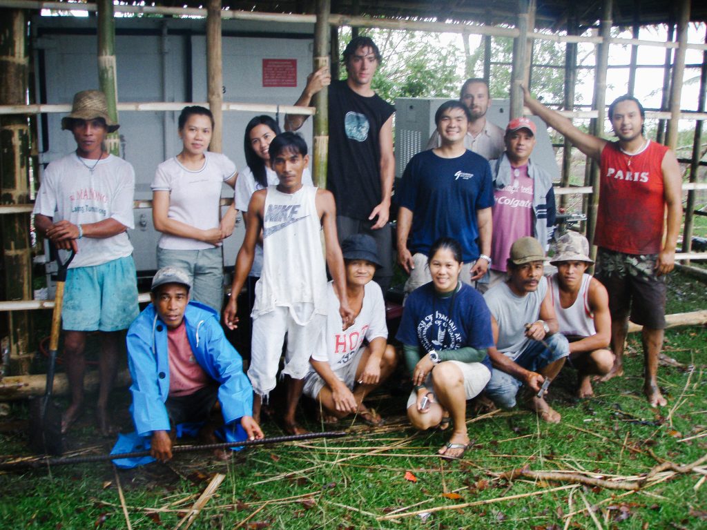
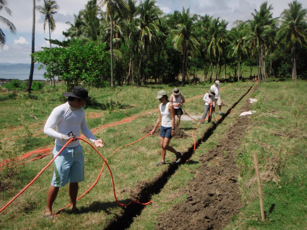
Dr. Repollo would like to acknowledge the captain and crew of the R/V Melville and the many U.S. and Philippine students, technicians, volunteers, and scientists who participated, assisted, and helped in the cruises and fieldwork in Antique, Philippines. She would also like to thank the local government units and people of municipalities of Pandan, Tobias Fornier, and Laua-an, Antique, for their full support and assistance. The team is indebted to the landowners, the late Enrique A. Zaldivar of Pandan; Erlinda B. Montero of Laua-an; Maria A. Moscoso, represented by her son Ramon A. Moscoso Jr.; Ernesto P. Near; and Ronelia Tingocia of Tobias Fornier for their kindness and hospitality.
This research work was funded by the Office of Naval Research (ONR) through the Philippine Strait Dynamics Experiment (PhilEx) program, under Award and Subaward to Dr. Pierre J. Flament of the University of Hawaii and Dr. Cesar Villanoy of the University of the Philippines, respectively.
Writers: Mia N. Judicpa, Gabrielle A. Abrahan
Graphics: Roy C. Corvera
References:
1. What is a gyre?. Oceanservice.noaa.gov. Retrieved 28 February 2022, from https://oceanservice.noaa.gov/facts/gyre.html.
2. Benitez-Nelson, C. R., Bidigare, R. R., Dickey, T. D., Landry, M. R., Leonard, C. L., Brown, S. L., et al. (2007). Mesoscale eddies drive increased silica export in the subtropical Pacific Ocean. Science, 316, 1017–1021. https://doi.org/10.1126/science.1136221.
3. Chen, X., Pan, D., Bai, Y., He, X., Chen, C. T. A., & Hao, Z. (2013a). Episodic phytoplankton bloom events in the Bay of Bengal triggered by multiple forcings. Deep-Sea Research Part I: Oceanographic Research Papers, 73, 17–30. https://doi.org/10.1016/j.dsr.2012.11.011.
4. Ning, X., Chai, F., Xue, H., Cai, Y., Liu, C., Zhu, G., & Shi, J. (2004). Physical-biological oceanographic coupling influencing phytoplankton and primary production in the South China Sea. Journal of Geophysical Research, 109, C10005. https://doi.org/10.1029/2004JC002365.
5. Yun, M. S., Kim, B. K., Joo, H. T., Yang, E. J., Nishino, S., Chung, K. H., et al. (2015). Regional productivity of phytoplankton in the western Arctic Ocean during early summer in 2010. Deep-Sea Research Part II: Topical Studies in Oceanography, 120, 61–71. http://dx.doi.org/10.1016/j.dsr2.2014.11.023.
6. Britannica, T. Editors of Encyclopaedia (2018, January 19). Panay. Encyclopedia Britannica. https://www.britannica.com/place/Panay-island-Philippines.
7. White, W.B., Tourre, Y.M., Barlow, M., Dettinger, M. (2003). A delayed action oscillator shared by biennial, interannual, and decadal signals in the Pacific basin. Journal of Geophysical Research C: Oceans 108, C3. https://doi.org/10.1029/2002JC001490.
8. McClean, J.L., Ivanova, D.P., Sprintall, J., (2005). Remote origins of interannual variability in the Indonesian throughflow region from data and a global parallel ocean program simulation. Journal of Geophysical Research C: Oceans, 110, C10. https://doi.org/10.1029/2004JC002477.
9. Pullen, J., Doyle, J.D., May, P., Chavanne, C., Flament, P., Arnone, R.A. (2008). Monsoon surges trigger oceanic eddy formation and propagation in the lee of the philippine islands. Geophysical Research Letters, 35 (7). https://doi.org/10.1029/2007GL033109.
10. Han, W., Moore, A.M., Levin, J., Zhang, B., Arango, H.G., Curchitser, E., Di Lorenzo, E., Gordon, A.L., Lin, J., 2009. Seasonal surface ocean circulation and dynamics in the philippine archipelago region during 2004–2008. Dynamics of Atmospheres and Oceans, 47 (1), 114–137. http://doi.org/10.1016/j.dynatmoce.2008.10.007.
11. May, P.W., J.D. Doyle, J.D. Pullen, and L.T. David. 2011. Two-way coupled atmosphere-ocean modeling of the PhilEx Intensive Observational Periods. Oceanography, 24 (1), 48–57. https://doi.org/10.5670/oceanog.2011.03.
12. Amedo-Repollo, C., Flores-Vidal, X., Chavanne, C., Villanoy, C., & Flament, P. (2021). Barotropic and baroclinic tides in Panay Strait, Philippines. Regional Studies In Marine Science, 41, 101612. https://doi.org/10.1016/j.rsma.2021.101612.
13. Yun, M., Kim, Y., Jeong, Y., Joo, H., Jo, Y., & Lee, C. et al. (2020). Weak Response of Biological Productivity and Community Structure of Phytoplankton to Mesoscale Eddies in the Oligotrophic Philippine Sea. Journal Of Geophysical Research: Oceans, 125(12). https://doi.org/10.1029/2020jc016436.