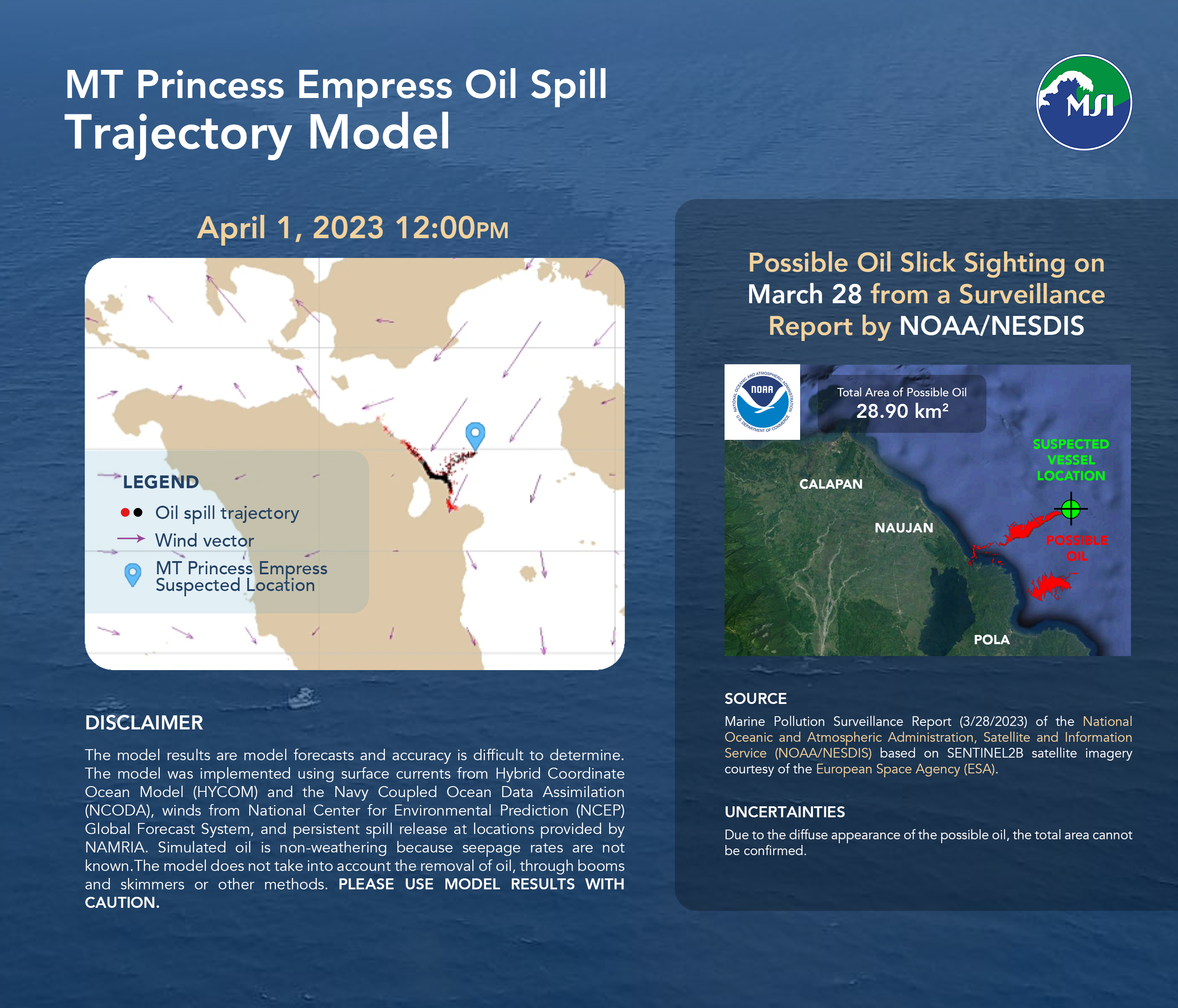
Bulletin 13: Seepage continues, slick heading to nearby coastal areas of Naujan, Pola, and Calapan
Featured image: Bulletin 13: Seepage continues, slick heading to nearby coastal areas of Naujan, Pola, and Calapan
Oil slicks from the location of the sunken tanker, MT Princess Empress, were seen towards Nauhan and in Pola Bay in the latest US National Oceanic and Atmospheric Administration (NOAA) report based on a satellite image taken yesterday, March 28, at 10:15AM. The slicks floating in the area around the sunken tanker show that oil was still leaking out as of yesterday, March 28. Oil spill trajectories for March 25-April 3 forecasts that the spill may be headed for Pola, Naujan, and along the coast to Calapan, Oriental Mindoro.
Source of satellite data: Marine Pollution Surveillance Report (3/28/2023) of the National Oceanic and Atmospheric Administration, Satellite and Information Service (NOAA/NESDIS) based on SENTINEL2B satellite imagery courtesy of the European Space Agency (ESA)
Uncertainties of Satellite Observations: Due to the diffuse appearance of possible oil, the total area cannot be confirmed.
Model Disclaimer: The model results are model forecasts and accuracy is difficult to determine. The model was implemented using surface currents from Hybrid Coordinate Ocean Model (HYCOM) and the Navy Coupled Ocean Data Assimilation (NCODA), winds from National Center for Environmental Prediction (NCEP) Global Forecast System, and persistent spill release at locations provided by NAMRIA. Simulated oil is non-weathering because seepage rates are not known. The model does not take into account the removal of oil, through booms and skimmers or other methods. Please use model results with caution.

